As you will see in this posting, the geology behind the recent earthquake in Turkey and Syria is rather complex although not surprising given that the area is prone to tectonic activity given its location where tectonic plates collide.
Here are two maps showing the basic geological setting of Turkey:

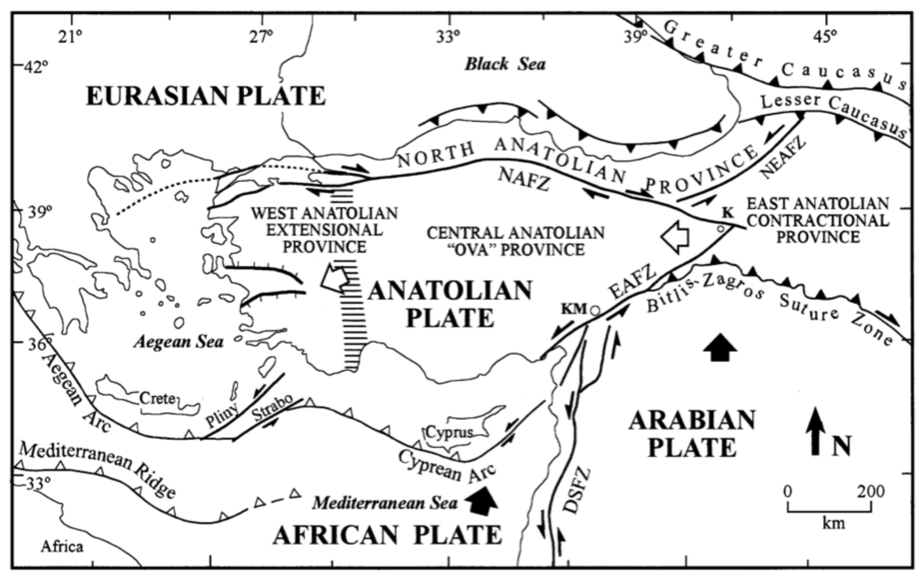
Here is a map which provides more detailed geological information:

Notice the two major faults labelled NAFZ and EAFZ which are located inside the borders of Turkey; the North Anatolian Fault Zone and the East Anatolian Fault Zone. These two faults are strike-slip or transform faults which connect tectonic plates that are moving in opposite directions; in this case, the Arabian Plate, the Anatolian Plate and the Eurasian Plate. Movement along the faults is horizontal as shown on this very basic block diagram:

As the plates try to slide past each other, energy builds up as a result of the horizontal shearing motion which is locked as a result of the friction between the plates. This friction suddenly suddenly releases and results in an earthquake. Earthquakes associated with transform faults are often shallow and have large lateral displacement.
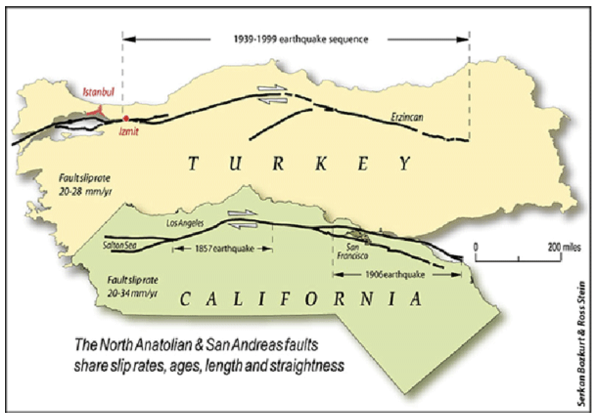
This is the same scenario as the San Andreas Fault in California, in fact, the two faults which are located along a continental margin (Pacific Ocean and Black Sea) are very similar in length as shown on this diagram:
In August 1999, movement along the North Anatolian fault (a right-lateral transform/strike-slip fault) resulted in the 7.4 magnitude Izmir earthquake and the deaths of 17,000 people and destroyed the homes of more than 250,000 people. The main earthquake was followed by a magnitude 7.2 earthquake in November 1999 which resulted in an additional 845 deaths.
The 2023 earthquake series is located along the East Anatolian Fault (a left-lateral transform/strike-slip fault). Here is a more detailed map of the East Anatolian Fault Zone (EAFZ) which runs roughly northeast-southwest through the map area:

The East Anatolian Fault forms the boundary between the Anatolian Plate (located under most of Turkey) and the Arabian Plate. As the Arabian Plate moves northward, it is squeezing out the Anatolian Plate which is colliding with the Eurasian Plate to the north as shown on these two diagrams:


The East Anatolian Fault Zone has a long history of earthquake activity as shown on this map from a study which analyzed the earthquake hazard for the fault zone:

This 2015 analysis calculated that there was a 90 percent probability of an earthquake with a magnitude of more than 6.0 in the next 43 years.
Let's close this posting with this map from the United States Geological Survey showing the earthquake activity (magnitude greater than 2.5) over the past day:

So far, there have been 76 earthquakes in the immediate area with the four largest as follows:

The largest earthquake, a 7.8 magnitude temblor, struck near Gaziantep at a depth of 18 kilometres followed 15 minutes later by a 6.7 magnitude quake near the site of the first event. There have been an additional 13 earthquakes/aftershocks with a magnitude of 5.0 or greater.
I hope that this information helps you to better understand the geology behind the February 2023 earthquake in Eastern Turkey.


Appartements as many as 10k were destroyed due to earthquake though the actual number is being censored right now. Considering that the first earthquake hit ca. 4AM in the morning, the death toll probably is probably between 400 - 500 thousand.
ReplyDelete